Geographic Information System & Remote Sensing
"By:"Mostafa SadeghnejadGeographic Information System & Remote Sensing
"By:"Mostafa Sadeghnejadدرباره من
 اینجانب مصطفی صادق نژاد کارشناس ارشد GIS و سنجش از دور و دانش آموخته مهندسی منابع طبیعی(مرتع و آبخیزدازی)دانشگاه تهران میباشم.مشاور در امورGIS- سنجش از دور- آبخیزداری-نقشه برداری-برنامه نویسی-تفسیر تصاویر ماهواره ای میباشم.برای ارتقاء و همکاری و هرگونه فعالیت علمی پژوهشی دست همه را به گرمی میفشاریم.دانش را برای آنکه خواهان نیست،عرضه مکن (کنفوسیوس)-ترس از انتقاد،موجب مرگ نبوغ میشود(ویلیام سیمز).انتقادات و پیشنهاد خود را به ایمیل زیرارسال نمایید.
پست الکترونیک : sadeghnejad@ut.ac.ir
ادامه...
اینجانب مصطفی صادق نژاد کارشناس ارشد GIS و سنجش از دور و دانش آموخته مهندسی منابع طبیعی(مرتع و آبخیزدازی)دانشگاه تهران میباشم.مشاور در امورGIS- سنجش از دور- آبخیزداری-نقشه برداری-برنامه نویسی-تفسیر تصاویر ماهواره ای میباشم.برای ارتقاء و همکاری و هرگونه فعالیت علمی پژوهشی دست همه را به گرمی میفشاریم.دانش را برای آنکه خواهان نیست،عرضه مکن (کنفوسیوس)-ترس از انتقاد،موجب مرگ نبوغ میشود(ویلیام سیمز).انتقادات و پیشنهاد خود را به ایمیل زیرارسال نمایید.
پست الکترونیک : sadeghnejad@ut.ac.ir
ادامه...
آمار : 14072 بازدید
Powered by Blogsky
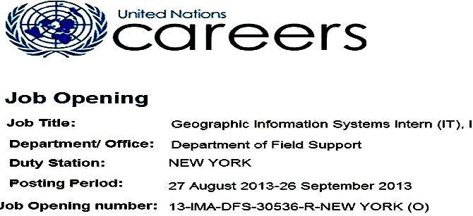
ثبت نام دوره ی کارآموزی GIS در سازمان ملل متحد(نیویورک-امریکا)........United Nation Careers-GIS Intern
Under the direct supervision of the Chief of the Cartographic Section or
his/her designated officer, the incumbent is responsible for the following
duties in the Cartographic Section of the Specialist Support Service (SSS),
Logistics Support Division (LSD), Department of Field Support (DFS):
Assistance in providing cartographic and geographic information services to the
Secretariat as well as the Security Council; Assistance in providing timely
geographic information support to peacekeeping and other United Nations
operations; Assistance in maintaining geographic databases including satellite
imagery and gazetteers; Assistance in preparing production of small-scale
briefing maps and large-scale planning and operation maps; Assistance in
geographic data collection, analysis and studies for projects developed by the
Cartographic Section (e.g. UNmap, UN Gazetteer, UN Earth, UN International
Boundary Information Services, etc.); Assistance in designing and developing
software aiming at geographic data collection, analysis and studies for
projects developed by the Cartographic Section (e.g. UNmap, UN Gazetteer, UN
Earth, UN International Boundary Information Services, etc.); Performs other
functions as required.
Competencies
Communication:
-Speaks and writes clearly and effectively
-Listens to others, correctly interprets messages from others and responds
appropriately
-Asks questions to clarify, and exhibits interest in having two-way
communication
-Tailors language, tone, style and format to match the audience
-Demonstrates openness in sharing information and keeping people informed
Teamwork:
-Works collaboratively with colleagues to achieve organizational goals
-Solicits input by genuinely valuing others’ ideas and expertise; is willing to
learn from others
-Places team agenda before personal agenda
-Supports and acts in accordance with final group decision, even when such
decisions may not entirely reflect own position
-Shares credit for team accomplishments and accepts joint responsibility for
team shortcomings
Client Orientation:
-Considers all those to whom services are provided to be “clients ” and seeks
to see things from clients’ point of view
-Establishes and maintains productive partnerships with clients by gaining
their trust and respect
-Identifies clients’ needs and matches them to appropriate solutions
-Monitors ongoing developments inside and outside the clients’ environment to
keep informed and anticipate problems
-Keeps clients informed of progress or setbacks in projects
-Meets timeline for delivery of products or services to client
Education
Applicants must be enrolled in a degree programme in a graduate school
(second university degree or higher), preferably in a Computer Science related
degree involving Geographic Information Systems (GIS) or other related
discipline that involves a substantial GIS component, and web technologies; or
if pursuing their studies in countries where higher education is not divided
into undergraduate and graduate stages, must have completed at least four years
of full-time studies at a university of equivalent institution towards the
completion of a degree.
Be computer literate in standard software applications;
Have a demonstrated keen interest in the work of the United Nations and have a
personal commitment to the ideals of the Charter; and
Have demonstrated the ability to successfully interact with individuals of
different cultural backgrounds and beliefs, which include willingness to try
and understand and be tolerant of differing opinions and views.